What 30 years of satellite data shows about the growth of more than 1,550 cities around the world
(ABC) -- Scientists have used a new technology to map more than 1,000 cities around the world and determine how they have changed over the past 30 years.
University of New Hampshire researchers used satellite data from between the 1990s and 2010s to map the footprints of 1,550 cities around the world to determine whether they had grown up, out or not at all.
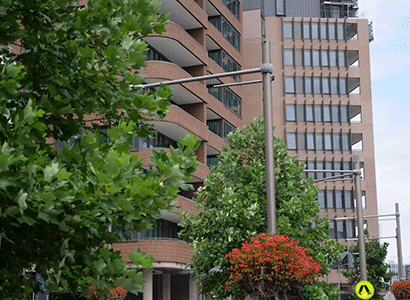 |
| High-density housing has emerged in more recent times as a solution to a number of planning issues associated with urban sprawl. – Photo ABC Radio Sydney: Natalie Agius |
Urban development research has previously used a similar method to determine how built environments change, but it has often been restricted to the past 10 years of available imagery.
The new study is one of the first of its kind to offer a comprehensive look at how cities have changed over a 30-year period.
“Our study presents a data-based measure of 3D urban change over multiple decades,” the study said.
“Unlike earlier global studies assessing 3D growth over a single decade, for example, the three decades of data show regionally varying accelerations and decelerations in rates of upward and outward growth and shifts in the dominant growth typology.”
Scientists used the time period to determine cities around the world were “rapidly growing”, and “mostly growing vertically than horizontally”.
“The 2010s are more characterised by tall building development, with much more area in upward typologies in the 2010s (28 percent) than in the 2000s (9 percent) or the 1990s (7 percent),” the study found.
“Historically, large-scale high-rise development was mostly limited to few megacities such as New York, Tokyo and Shanghai.
“However, we have observed a shifting trend toward upward building growth across many cities and regions.”
Scientists said cities often centred most of their upwards growth around periods of extreme economic development.
“Since the 1990s, especially in rapidly developing world regions, cities have transitioned from low-rise, outward growth to more high-rise, upward growth,” the study said.
The study said Chinese cities were an example of economic-development-impacted urban design.
“The study highlights a unique urban upward growth, mostly found in Chinese cities and a consequence of the real estate boom there,” it said.
“Between 2003 and 2014, 100 billion square feet of residential real estate was constructed in Chinese cities.
“To put this into perspective, in 2018, total commercial real estate in the USA was 96 billion square feet.
Students in Seoul are paying US$11 a month in rent. Here’s how they’re doing it.
“However, as our results show, Chinese cities not only expanded in total volume, the fast-up-and-out typology indicates that there were many tall buildings constructed during this period.
“In 2017, 66 percent of the completed skyscrapers worldwide that were 250 metres or taller were built in China.
“The fast pace of skyscraper construction in China during this period is indicative of the rapid increase in land prices.”
Bill Randolph, from the University of New South Wales in Sydney, said the research was crucial for governments to plan for the future.
“The longer you can understand what the trends are over time, the better chance you have of understanding where it might be going into the future,” he said.
“If they’ve got the technology available to [map that], that’s terrific.
“If we don’t understand how our cities are working and how well they’re working for their populations, then we won’t be able to plan them properly.
“We need to know how society works, and urbanisation is a key driver at the moment.”
Professor Randolph said the observations from the study matched his own views about the increasing importance of density development in the modern world. “You only have to travel modestly to see that cities have begun intensely densifying,” he said.
“It’s happening in every city that has economic dynamism. You would expect economic growth to accompany that densification process.”
Professor Randolph said it was important for cities to plan for high-density living.
“Transport is a real driver of what we have in our built environment,” he said.
Informal tracks that defy formal city footpaths can be charming, but urban designers say paying attention to them can also help create better, safer public spaces.
“People got about in the 20th century via car, and that led to individuals being able to travel more widely, and the suburbs reacted in the same way.
(Latest Update August 6, 2024)
|