BRI Summit kicks off in Hong Kong, explores opportunities in emerging markets
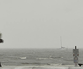 |
| Winds and heavy downpour on Harrison County Beaches in Pass Christian, Miss, due to Hurricane Francine Wednesday, September 11, 2024 (Hunter Dawkins/the Gazebo Gazette via AP). |
Warm oceans strengthened Hurricane Francine and could power more Fall storms
(AP) -- Warm water in the Gulf of Mexico helped quickly strengthen Hurricane Francine, creating danger for Louisiana residents rushing to buy supplies and secure their homes ahead of the storm’s landfall Wednesday.
Warm ocean water is essential for forming and strengthening hurricanes. Heat helps the water evaporate faster, fueling the storm and producing more rainfall.
Mid-September is typically the peak of hurricane season and Francine moved through a part of the ocean that held an exceptional amount of energy.
As of Wednesday afternoon, Francine had strengthened to a Category 2 hurricane with sustained winds of nearly 100 mph (161 kph).
Hear’s how high Gulf of Mexico water temperatures are effecting Francine and the hurricane season:
HOW HOT IS THE WATER?
The Gulf of Mexico doesn’t need record setting temperatures to form hurricanes this time of year. Still, Francine traveled through water that at the surface, was somewhat hotter than average, but not record setting. The storm passed over a patch that was roughly 86 to 88 degrees (30 to 31 Celsius).
What’s exceptional is the amount of heat deeper down. Storms churn up the ocean, bringing to the surface cooler water.
Recently, however, that deeper layer was record-setting. It held more heat than at any point in the last decade, according to Brian McNoldy, a senior research associate at the University of Miami’s Rosenstiel School of Marine, Atmospheric, and Earth Science.
“This past week was pretty exceptional,” he said.
And Francine passed over a patch of water, called an eddy, that was especially hot.
Near the coast, however, the water is a bit cooler than average, meaning there’s less energy to strengthen the storm.
“It’s window for really intensifying is closed, so that’s good news,” he said.
HOW DID FRANCINE REACT?
Warmer water lower down matters most for large, strong storms that move slowly — that’s the recipe for churning up a bunch of deeper water.
“On the opposite end of that, a weaker, smaller, quicker moving storm will hardly churn up the ocean at all,” said McNoldy. For these storms, the temperature of deeper water matters less.
Francine isn’t extremely strong, so the energy stored deeper in the Gulf of Mexico didn’t matter quite as much, according to McNoldy.
(Latest Update September 13, 2024)
|