Strengthening disaster preparedness in Laos through digital transformation and community action
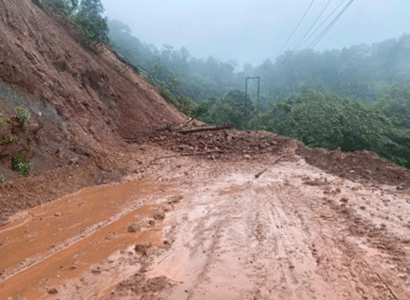
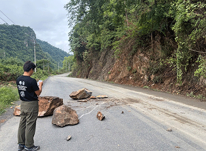
Every year, as the monsoon approaches, Lao brace for impact as storms, floods and landslides halt their daily lives. Landslides block roads to the district centers and markets, flooded bridges cut off access to schools and hospitals, heavy winds damage crops, and fallen electricity pole leaves households without power for days.
These are very common scenarios in many parts of the country. A 2021 hazard assessment by UN-Habitat estimated that nearly half of the country’s villages – about three million people - are exposed to at least one weather-related hazard. With climate change intensifying these hazards, disaster exposure and risks are expected to grow.
Effective disaster risk management depends on knowing where and when hazards may occur and what the impact could be, so that preparations can be made in advance. Once disaster unfolds, it’s important to know what is happening where and who is affected so that response can be prompt and lives and assets can be saved.
 |
Yet, local authorities are facing difficulties in these actions due to the lack of accessible and actionable data and information.
The Gap: Fragmented and Unstructured Disaster Information
Information on hazards, vulnerable communities and critical infrastructure is often distributed across different agencies and administrative levels. National meteorological and disaster management agencies generate weather forecasts, alerts and warnings which are communicated through official channels to the villages. Villagers report hazard incidents, such as floods or landslides through social media messaging or phone calls. Research studies, surveys and assessments conducted by universities, government and non-government agencies contain evidence that could support risk mitigation and management, but are spread across multiple reports, maps or datasets.
Therefore, the problem is not a lack of data. The problem is ‘siloed’ information that does not come together in a timely and systematic manner to support common operational picture and decision-making, especially at grassroot levels. For example, without vulnerability information, weather alerts remain generalised, making it harder for district authorities to decide when and whom to evacuate, rescue or provide relief. Similarly, community incident reports through phone calls or social media do not follow a standardised structure, resulting in delays in detection, verification and prioritisation of incidents for response. More importantly, without structured data management systems, information is generally lost, and it becomes harder to identify risk hotspots, prioritise risk mitigation measures or design preparedness and response plans that reflect what is needed and what is happening on the ground.
Digital Transformation and Community Action in Disaster Management
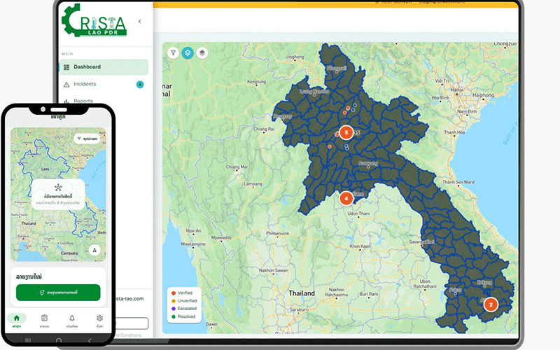
Recognising this gap, disaster researchers at the Asian Institute of Technology (AIT) in Thailand and the National University of Laos (NUoL) developed CRISTA (Climate Resilient Infrastructure for Social Transformation and Adaptation) Laos, a digital system that improves disaster preparedness and emergency response by providing a shared platform where local authorities, communities and humanitarian agencies can collaborate to generate, analyse and act upon risk and incident information.
The system currently operates on two major pillars of data. First, all data and information available in surveys, reports, risk assessments and online sources are consolidated to build a comprehensive geospatial database, which provides essential information on exposure and vulnerabilities of people, infrastructure and assets. Second, the CRISTA mobile application allows villagers to report hazards and disruptions as they occur, providing a granular real-time monitoring capability for the local authorities.
 |
 |
Collectively, the system helps local authorities to have a comprehensive understanding of disaster risks, impacts, needs and priorities across their entire district or province, supporting faster and more effective decisions. For villagers, it provides a structured way to report incidents and damage, share observations and receive warnings and advisories for anticipatory action.
Successful pilots in Luang Prabang
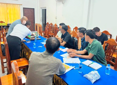
Since June 2026, AIT and NUoL have been testing the system in Nambak and Ngoi districts of Luang Prabang province. Training and awareness activities have introduced community members and local officials to the system. More than 250 people have downloaded the application, and more than 300 reports have been submitted to the system during the pilot.
The pilot is an important testing and learning process that demonstrates that communities and local authorities in Laos can engage with and operate such digital platforms, and that there is potential to connect community observations with institutional disaster-management processes.
Towards an integrated DRR ecosystem for Laos
Disaster risk management is not the responsibility of a single institution. Central, provincial and district government agencies, communities, researchers, international agencies, humanitarian organisations and NGOs each play essential roles in the disaster management cycle; and each holds part of the information needed to understand and manage disaster risk.
Therefore, Laos needs to move towards a more integrated disaster risk reduction ecosystem, in which information, institutions, technologies and people are connected rather than operating in isolation. Such an ecosystem could bring together forecasts, alerts and warnings, community-generated incident reports, vulnerability and risk assessments and infrastructure databases onto a single geospatial platform, contributing to a shared evidence base that helps decision-makers understand where risks are concentrated, which communities and assets are most vulnerable, and where preventive action is needed.
For such an ecosystem to be sustainable, however, technology alone is not enough. Four forms of ownership need to be in place. Institutional ownership, so that digital solutions are embedded within the workflows and priorities of the institutions responsible for disaster risk management. Data ownership, so that communities and local institutions retain appropriate control over the information they generate. Operational ownership, built through clear standard operating procedures, defined roles and data verification and utilisation processes. And financial ownership, a credible pathway towards public or institutional financing so that the system can be maintained beyond the life of any single project.
The goal is to have better-connected systems that enable better decisions. CRISTA has already demonstrated the potential for communities and local authorities to systematically collaborate through a shared platform. An integrated disaster risk reduction ecosystem for Laos, one that brings community observations, hazard data and institutional decision-making onto a single, shared platform, could be the difference between simply responding to disasters and staying ahead of them.
Authors: CRISTA Project Manager, Mr Ayush Baskota and CRISTA Project Co-PI, Ms Oulavanh Sinsamphanh.
(Latest Update November 20, 2026)
|